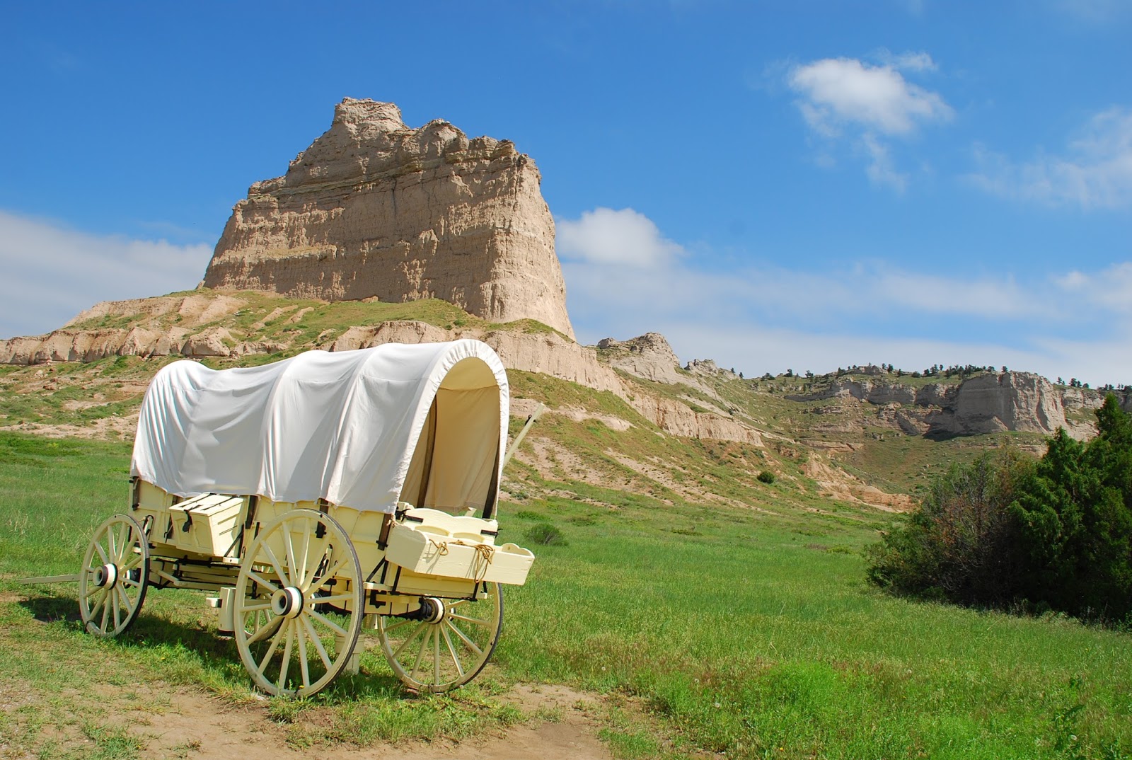
The lone wagon shown against Scott's Bluff is the type that had to be lowered over Windlass Hill. See text below.
We have talked about Ogallala and Sidney to explain the
relationship to the westward movement as being in the middle of an area along
the North and South Platte rivers . Here geography resulted in the ongoing
arrival of future residents of the Pacific coastal states via the Columbia
River (pretty much straight west of the Platte) and California via the Mohave
Desert and plains. We need to backtrack a bit to the earlier 1800s.
In the beginning, the valley of the Platte was a logical
entry through the increasingly rugged sets of buttes and mountains that must be
overcome. As early as the 1820s fur trappers, most of them traveling alone or
in small groups, used the Platte as the route to the Rocky Mountains to look
for beaver. Beaver hats popular with wealthy Easterner dudes and, even more,
perhaps, British "toffs." created a booming market for beaver fur.
The Native Americans,
however, were increasingly concerned
about the inroads of pioneers into their hunting grounds. William Ashley and
his men began to use the Platte corridor to avoid the Lakota and Cheyenne
tribes with homelands more to the north from 1824 to 1827. In 1832, Benjamin Bonneville successfully
traveled through the Platte area and built a trading camp or small fort in Wyoming that was
a failure. However, Bonneville continued on to the Columbia River, where Fort
Astor and later Fort Vancouver were operated by Hudson's Bay people and viewed
him rightly as a competitor. Bonneville proceeded then to explore the
California cutoff trail that emanated at the junction of the North and South
Platte of today's Nebraska. It tended to follow what is today I-80, formerly
the Lincoln Highway, first transcontinental highway.
You have heard of the "Green Mountain boys" These
were Rocky Mountain area trappers who decided to have an annual sort of trade
fair, where potential buyers and sellers (usually individuals or small
partnerships) met somewhere in the Rockies to trade, usually Wyoming. These affairs
turned out to be for riotous living, drinking, meeting females (mostly local
Indians smitten with gifts of goods never before imagined). More business
minded, Ashley used 10 mule-drawn wagons and 81 men to protect the booty to
cross the Wind River Mountains, and reported to the government of the
feasibility of such travel.
The first known party to travel through the Platte Valley
was the Bidwell-Bartleson Party in 1841. The wagon trains would continue to
bring new western residents toward the Pacific until after the transcontinental
railroad was completed to their destinations in 1869. Wagons continued to roll
in ever fewer numbers but on through the 70s, thus mingling with gold
prospectors and cattlemen in the Platte area for awhile.
During my recent explorations of the North Platte and
northwest corner of Nebraska area, I visited with keen interest a wagon train
barrier that became known as Windlass Hill at what is now called Ash Hollow
State Historical Park. The name "Windlass" says it all. It was a deep
valley where emigrant wagons and teams were stumped for awhile. They figured
out how to lower the wagons into the valley by fastening them to teams of oxen
at the top of the slope or to strong men and ropes, thus slowing the descent to
a manageable speed and avoiding damage. Once down into this verdant, spring-fed
valley of green grass and one of the only tree groves in the surrounding area,
the travelers tended to hang out there for several days to rest, maybe dance a
little, and let their teams of oxen or horses fill their bellies with good
grass The valley continued as part of the Oregon Trail route. Today the hill still
shows ruts from all those wagon wheels down the slope. Like me, many were
thrilled to walk in or near the ruts "drug out of the dirt" fully 175
years ago! In one case, a ravine maybe
five feet deep has resulted, path for water drainage or collection, but mostly
the ruts are shallow. As an historical park, a walkway has been provided all
the way to the top of the slope. In 2015 during the seemingly endless rainy
spring the place was a paradise of greenery. Can't you just see the hot, tired
travelers stretched out on the grassy hillside and hear their laughter and
banter as they relaxed, cooked, sewed their clothes, repaired damaged wagons,
and enjoyed the relief to be down a stern barrier looking westward?
(Windlass Hill or Ash Hollow site is not far south of
today's Lake Mcconaughy or village of Lewellen.)
No comments:
Post a Comment